Södra Station is two things at once: a commuter-rail stop cut into the southern edge of Södermalm, and the residential district — officially Södra Stationsområdet — that grew up around it from the 1990s onward. The area sits on land that was once a railway marshalling yard, and today it is one of Stockholm’s clearer examples of a former industrial site converted into ordinary city housing.
What is Södra Station, specifically?
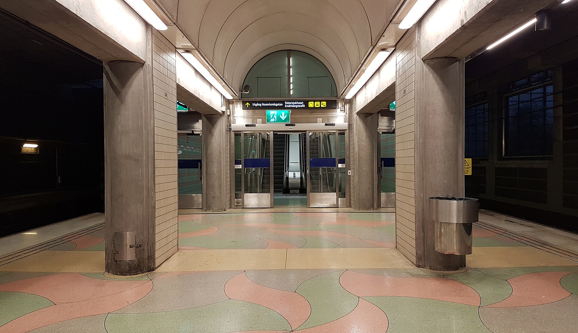
Södra Station is a stop on Stockholm’s pendeltåg (commuter rail) network, operated by SL, located on the southern side of Södermalm. It is not a mainline or intercity station — long-distance trains do not stop there — and its platforms sit in a cutting below street level, a physical trace of the railway land it was built into.
Around the station, the same name is used loosely for the surrounding neighbourhood: streets of mostly 1990s apartment blocks, small parks, and a scattering of institutional buildings, wedged between the older, denser core of Södermalm and the water of Årstaviken to the south.
Where exactly is it, relative to the rest of Södermalm?
Södra Station sits at the southern rim of Södermalm, Stockholm’s large southern-island district, roughly between the busier hub at Skanstull and the water. Ringvägen, the ring road that traces much of Södermalm’s older boundary, runs close by, and the green-line metro stop at Skanstull is within easy walking distance for anyone coming from the more built-up northern part of the island.
To the south, the district faces Årstaviken, a narrow inlet of Saltsjön that separates central Södermalm from the Årsta and Liljeholmen areas on the mainland side. That waterfront edge, plus the railway cutting on the other side, gives the neighbourhood a fairly self-contained shape rather than blending seamlessly into the rest of Södermalm.
What was on this site before the housing?
Before it was a residential district, this land was part of Stockholm’s southern railway marshalling yard — a sorting and staging area for goods wagons serving the approach into the city from the south. As Sweden’s freight-rail operations were reorganised over the twentieth century and less land was needed for sorting yards close to the centre, large sections of the site were released for other uses.
Stockholm’s city planners used the freed land for housing rather than commercial development, which is why the district reads today as almost entirely residential, with schools, small parks and local shops rather than offices or retail chains. It is a smaller and earlier example of the same pattern later repeated, on a larger and more publicised scale, at Hammarby Sjöstad, where a former industrial and harbour area on the other side of the water was rebuilt as a purpose-planned neighbourhood.

What does the district look like today?
The built environment is recognisably late-twentieth-century Swedish urban housing: mid-rise apartment blocks arranged around courtyards, a fairly consistent building height, and a street layout that favours pedestrians and cyclists over through-traffic. There is little of the older stone architecture found further north on Södermalm, and no equivalent of the tourist-oriented cafés and boutiques clustered around SoFo or Nytorget.
The district includes green space along its edges, and its position on Årstaviken means several streets and courtyards have water views that are unusual for a district built this densely. For residents, the appeal is largely practical: newer housing stock, decent transit access, and proximity to central Stockholm without the density or tourist traffic of Gamla Stan or the northern half of Södermalm.
How do you get to and from Södra Station?
Södra Station’s main transport role is as a commuter-rail stop, giving direct pendeltåg access south toward destinations along SL’s southern lines and north into central Stockholm. Because it is a local stop rather than an interchange for regional or intercity trains, most journeys beyond the immediate area involve changing at Stockholm City or another hub.
- Pendeltåg (commuter rail): direct service through Södra Station, operated by SL — check SL’s own site for current lines and timetables.
- Metro: the green line stop at Skanstull is within walking distance for onward travel across the wider network.
- Bus: several SL bus routes serve Ringvägen and the surrounding streets.
As with any SL service, fares run on the zone-and-card system used across greater Stockholm; anyone planning a trip through the area should confirm current fares and timetables directly with SL rather than relying on a fixed figure, since these change periodically. Readers new to the system generally find the fare structure covered more fully in the site’s Getting Around archive.
What is Södersjukhuset, and why is it here?
Södersjukhuset — literally “the southern hospital” — is one of Region Stockholm’s larger hospitals, and it sits adjacent to the Södra Station district. Its presence here is one reason the area has a slightly institutional edge distinct from the purely residential blocks nearby: hospital staff, ambulance access routes and related services occupy a meaningful share of the surrounding streets.
For residents of southern Södermalm and beyond, Södersjukhuset functions as a major acute-care hospital within the Region Stockholm system. It is not a tourist site, and this article makes no claim about the standard of care there beyond noting its scale and location — readers with a medical concern in Sweden should consult Sweden’s own official healthcare guidance (1177.se) or their home government’s travel advice rather than anything written here.
What else is nearby?
Beyond the immediate district, the area functions as a connecting point between several better-known parts of southern Stockholm. Skanstull and Medborgarplatsen, both busy nodes on the northern side of the same island, are a short journey away, and the Avicii Arena — the distinctive spherical venue formerly known by another name — sits across the water toward Johanneshov, within the same general southern quarter of the city.
For anyone assembling a wider picture of Södermalm’s edges, the district sits alongside other examples of Stockholm turning former industrial or infrastructure land into housing, a pattern explored in more detail in the site’s coverage of Hammarby Sjöstad and in the broader Neighbourhoods archive.
Is Södra Station worth a visit for someone not staying there?
There is little in the district itself aimed at short-stay visitors — no major museum, listed monument or historic square comparable to those found in Gamla Stan or on Djurgården. Its interest is mostly to readers trying to understand how Stockholm actually functions as a lived-in city: how railway land gets recycled into housing, how a district can sit inside a famous island without resembling the postcard version of it.
Anyone drafting an itinerary around the city’s major sights is better served starting from the site’s Stockholm Guide hub, while readers thinking about longer stays, commuting patterns or day-to-day city life will find that covered more directly in Living in Stockholm. Practical planning — cards, zones, and how the transit system holds together across a visit or a year — is gathered in Stockholm Practical.
Access Stockholm is an independent guide written from published, checkable sources. We have not visited the places described here and we do not publish personal recommendations or invented ‘local favourites’ — where something is singled out as notable, we say who says so. Opening times, fares, closures and prices change at short notice, so treat everything here as a starting point and confirm with the museum, operator or venue directly before building a day around it. We give no advice on visas, insurance, health or safety; use your own government’s official guidance for those.
Featured image: Photo by Jan Ainali, source, CC BY-SA 4.0
