Gärdet is a district in northeastern Stockholm, part of the Östermalm borough, built around a large open grass field once used by the military and now a public park. It also names a residential area of 1930s functionalist apartment blocks and a Red Line metro station of the same name.
Where is Gärdet, and what borough is it part of?
Gärdet sits at the northeastern edge of Östermalm, one of Stockholm’s central boroughs, between the water of Djurgårdsbrunnsviken and the approach to Ladugårdsgärdet’s open ground. It borders Djurgården to the south and the Norra Djurgården area to the east, and is administered as one of Östermalm’s constituent districts by the City of Stockholm.
Because it lies just past the built-up grid of central Östermalm, Gärdet reads as a transition zone: dense city streets give way, fairly abruptly, to open sky and grass. For the layout and history of the borough it belongs to, see what Östermalm is and how it was laid out.
Why is there so much open field here?
The field is Ladugårdsgärdet — literally “the barn’s field” — a name that survives from when the area was farmland attached to the royal estates. From the 17th century onward it was used as a military exercise and parade ground, which is why it was kept clear of buildings while the city grew up around it.
That military use ended long ago, but the open ground remained public land. Today it functions as one of inner Stockholm’s largest unbroken green spaces, used for kite flying, informal sport, dog walking, and as a natural gathering point when large crowds need somewhere to stand — for public celebrations, fireworks viewing, and outdoor events whose exact dates change year to year and are best confirmed through the City of Stockholm’s own event listings.
Is Gärdet part of the Royal National City Park?
Yes. Ladugårdsgärdet falls within Kungliga nationalstadsparken, the Royal National City Park, a protected green corridor running from Ulriksdal in the north down through Norra Djurgården, Gärdet and Djurgården. Sweden designated it in 1995 as the country’s first national city park, a status meant to keep this chain of green space from being built over as the city expands.
Djurgården, at the park’s southern end, is the better-known part of this corridor and carries most of the city’s national museums; Gärdet’s field is the open, undeveloped stretch that connects it back into the city. For how that green wedge continues south, see what Djurgården is and why so much of it is parkland.
What does the residential Gärdet look like?
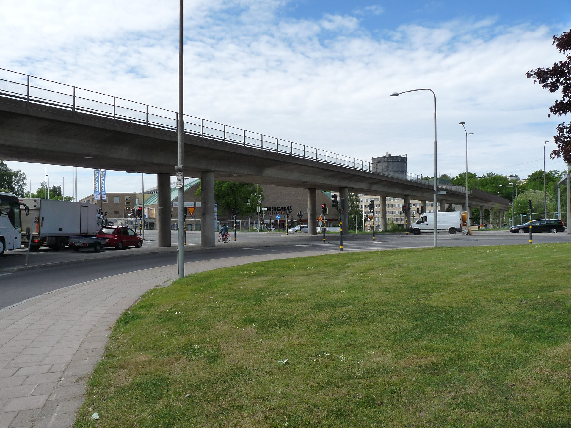
Away from the open field, Gärdet is also a named residential district built largely in the 1930s and 1940s as an example of Swedish functionalism — plain, unornamented apartment blocks (often called lamellhus, long slab buildings set at right angles to the street) arranged in green surroundings rather than along a tight urban grid.
The layout was a deliberate departure from the stone-built, courtyard-block streets of central Östermalm and Norrmalm: buildings turned to catch light and air rather than to close off a street front, with grass and trees left standing between them. It’s one of the more legible examples in the city of interwar planning ideas about air, light and greenery being applied at district scale.
How do you get to Gärdet?
Gärdet has its own station on the Red Line (Röda linjen) of the Stockholm metro, run by SL (Storstockholms Lokaltrafik), sitting between Karlaplan and Ropsten on the branch toward Mörby centrum. The station opens directly onto the edge of the field.
Bus routes also cross the district, connecting it to Östermalm and to Djurgården’s museum cluster. As with the rest of the metro network, travel here runs on SL’s zone-based card system rather than single paper tickets; current fares and zone maps are published on SL’s own site. For how the wider system fits together, see the site’s Getting Around archive and the practical planning hub.
What museums and landmarks are near Gärdet?
Several of Stockholm’s national museums sit at the edge of the field, on the approach to Djurgården, rather than in the residential streets themselves:
- Tekniska museet, Sweden’s national museum of science and technology, stands on Museivägen at the field’s edge — see what Tekniska museet holds.
- Sjöhistoriska museet, the national maritime museum, sits alongside it on the same stretch of shoreline.
- Etnografiska museet, the Museum of Ethnography, part of Sweden’s National Museums of World Culture, is a short distance further along Djurgårdsbrunnsvägen.
- Kaknästornet, the Kaknäs telecommunications tower completed in 1967, rises from the wooded ground just east of the field and was for decades among the tallest structures in the Nordic countries.
Together with the concentration of institutions on Djurgården proper, these museums illustrate a pattern explained more fully in why so many of Stockholm’s museums sit on Djurgården, and browsable more broadly via the museums and galleries archive.
What is Gärdet like to live in?
For residents, Gärdet functions as a quieter, greener extension of Östermalm — apartment living with immediate access to open ground, water, and the museum cluster on Djurgården’s doorstep, but fewer shops and restaurants than the borough’s central streets around Karlaplan or Östermalmstorg. It suits people who want proximity to the centre without living directly in its densest blocks.
The trade-off is the one built into the district’s own layout: the same openness that makes the field valuable as parkland means fewer commercial streets nearby, and daily errands tend to be run either toward Östermalm’s centre or toward the shops around Ropsten. For a broader sense of how Stockholm’s residential districts differ in this way, see the living in Stockholm hub and the neighbourhoods archive.
Is Gärdet worth visiting if you don’t live there?
As a destination in its own right, Gärdet is mostly the field and the museum cluster at its edge rather than a shopping or dining district. Visitors typically pass through on the way to Tekniska museet, Sjöhistoriska museet or Kaknästornet, or use the open ground itself for a walk with a clear view back toward the city and out over Djurgårdsbrunnsviken.
It sits within easy reach of the denser sightseeing routes covered in the site’s Stockholm guide hub, which sets out how museums, landmarks and neighbourhoods across the city connect to one another.
Access Stockholm is an independent guide written from published, checkable sources. We have not visited the places described here and we do not publish personal recommendations or invented ‘local favourites’ — where something is singled out as notable, we say who says so. Opening times, fares, closures and prices change at short notice, so treat everything here as a starting point and confirm with the museum, operator or venue directly before building a day around it. We give no advice on visas, insurance, health or safety; use your own government’s official guidance for those.