Fjällgatan is a short cobbled street on the island of Södermalm, running along a ridge above Stockholm’s harbour. It is known for two things: a row of low wooden houses that survived the fires that destroyed most of Södermalm’s old timber buildings, and an open viewpoint over Gamla Stan, Skeppsbron and the water of Saltsjön.
Where is Fjällgatan in Stockholm?
Fjällgatan sits on the northeastern edge of Södermalm, the large island south of Gamla Stan. It runs roughly parallel to the waterfront but well above it, along the top of the steep slope that drops down to Stadsgårdshamnen, the harbour used by Baltic ferries and cruise ships. One end of the street meets the area around Mosebacke torg, a small square known historically for its outdoor entertainment venue; the other runs toward the stairs and lanes that connect down to Katarinavägen and, eventually, Slussen.
This puts Fjällgatan directly across the water from Gamla Stan, Stockholm’s medieval old town, and gives it an unusually direct sightline over the Royal Palace, Skeppsbron and the boats moving through the channel between Södermalm and the old city. For context on what sits on the other side of that view, see how Gamla Stan developed as Stockholm’s original settlement.
Why is Fjällgatan known for its view?
Because the street runs along an exposed ridge with no buildings blocking the water side, it functions as an open balcony over central Stockholm. From several points along Fjällgatan, the sightline takes in Gamla Stan’s rooftops, the ferries and harbour traffic below, and the wider mouth of Saltsjön where the Baltic meets the city’s inner waterways.
City guides to Stockholm routinely group Fjällgatan with the viewpoints along Södermalm’s northern edge, most often alongside Monteliusvägen, the cliffside path on the western side of the island. Between them, the two streets cover Södermalm’s northern rim from the harbour side to Riddarfjärden, giving broadly similar wide views of the city centre from opposite directions.
There is no admission fee to walk Fjällgatan and no formal viewpoint infrastructure — it is a public residential street, and the view is simply what the topography provides.
What are the wooden houses on Fjällgatan?
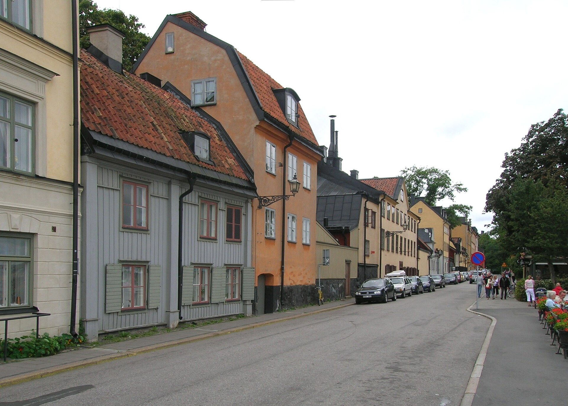
The low wooden buildings lining part of Fjällgatan date largely from the 18th century. Södermalm was repeatedly devastated by fire in the 17th and 18th centuries, and building regulations introduced afterward gradually restricted timber construction in favour of stone and brick, particularly along main streets. Most of the island’s older wooden housing stock was lost to those fires or later demolished during 19th- and 20th-century redevelopment.
The houses that remain on Fjällgatan are among the relatively small number of wooden buildings from that period still standing on Södermalm, which is why the street is often cited in discussions of the island’s building history rather than simply as a viewpoint. They are protected as part of the city’s built heritage, and their scale — one or two storeys, close to the street — is markedly different from the stone-built blocks that dominate the rest of the neighbourhood.

What is the literary connection to Fjällgatan?
The harbourside districts of Södermalm around Fjällgatan and Stadsgården are associated with the Swedish writer Per Anders Fogelström, whose sequence of novels beginning with Mina drömmars stad (“City of My Dreams”) is set among Stockholm’s working-class dockside communities in the late 19th and early 20th centuries. Local historical accounts of the area draw on Fogelström’s novels as a reference point for what the harbour and its surrounding streets were like before redevelopment, though the books themselves are fiction rather than a historical record.
How do you get to Fjällgatan?
Fjällgatan is reached on foot. The most common approaches are from Mosebacke torg at the top of the slope, or via one of the flights of stairs that climb from the harbour level near Stadsgårdshamnen and Katarinavägen. There is no metro or bus stop directly on the street itself.
The nearest transport hub is Slussen, the interchange at the northern tip of Södermalm where the Tunnelbana’s red and green lines meet buses and, seasonally, archipelago boats. Slussen has been substantially rebuilt in recent years; a separate explanation of why Slussen was reconstructed and how it now functions covers the current layout. From Slussen, the walk up to Fjällgatan involves a genuine climb, since the street sits well above the waterline.
Because the approach is on foot and involves stairs or a steep street, it is worth checking current route information from the City of Stockholm or Region Stockholm’s public transport operator, SL, if step-free access is a requirement — the terrain around this part of Södermalm is not flat by design.
Is there anything else nearby?
Fjällgatan sits within a stretch of Södermalm that includes Mosebacke torg and the approach to Katarina Church, and it connects, via the stairs down to the harbour, toward Slussen and the western side of the island. It is a residential street rather than a commercial one — there are no listed attractions, museums or shops specific to Fjällgatan itself, which is part of why guides to the area tend to describe it briefly and move on to the view rather than the street’s amenities.
For the island it belongs to more broadly, including how Södermalm functions as a district today, see the overview of Stockholm’s neighbourhoods. For other viewpoints, monuments and open-air sights around the city, the landmarks and sights section covers comparable locations, and general questions about routes, cards and how to move between them are addressed in the getting around section.
Is Fjällgatan worth including in a Södermalm walk?
Fjällgatan is short and can be covered in a few minutes, but it is usually treated as one stop within a longer route across northern Södermalm, taken together with Mosebacke torg, the stairs down to Slussen, and — on the opposite side of the island — Monteliusvägen. Because it is a public street with no opening hours, it can be reached at any time of day, though the view depends entirely on daylight and weather rather than any fixed schedule.
Access Stockholm is an independent guide written from published, checkable sources. We have not visited the places described here and we do not publish personal recommendations or invented ‘local favourites’ — where something is singled out as notable, we say who says so. Opening times, fares, closures and prices change at short notice, so treat everything here as a starting point and confirm with the museum, operator or venue directly before building a day around it. We give no advice on visas, insurance, health or safety; use your own government’s official guidance for those.