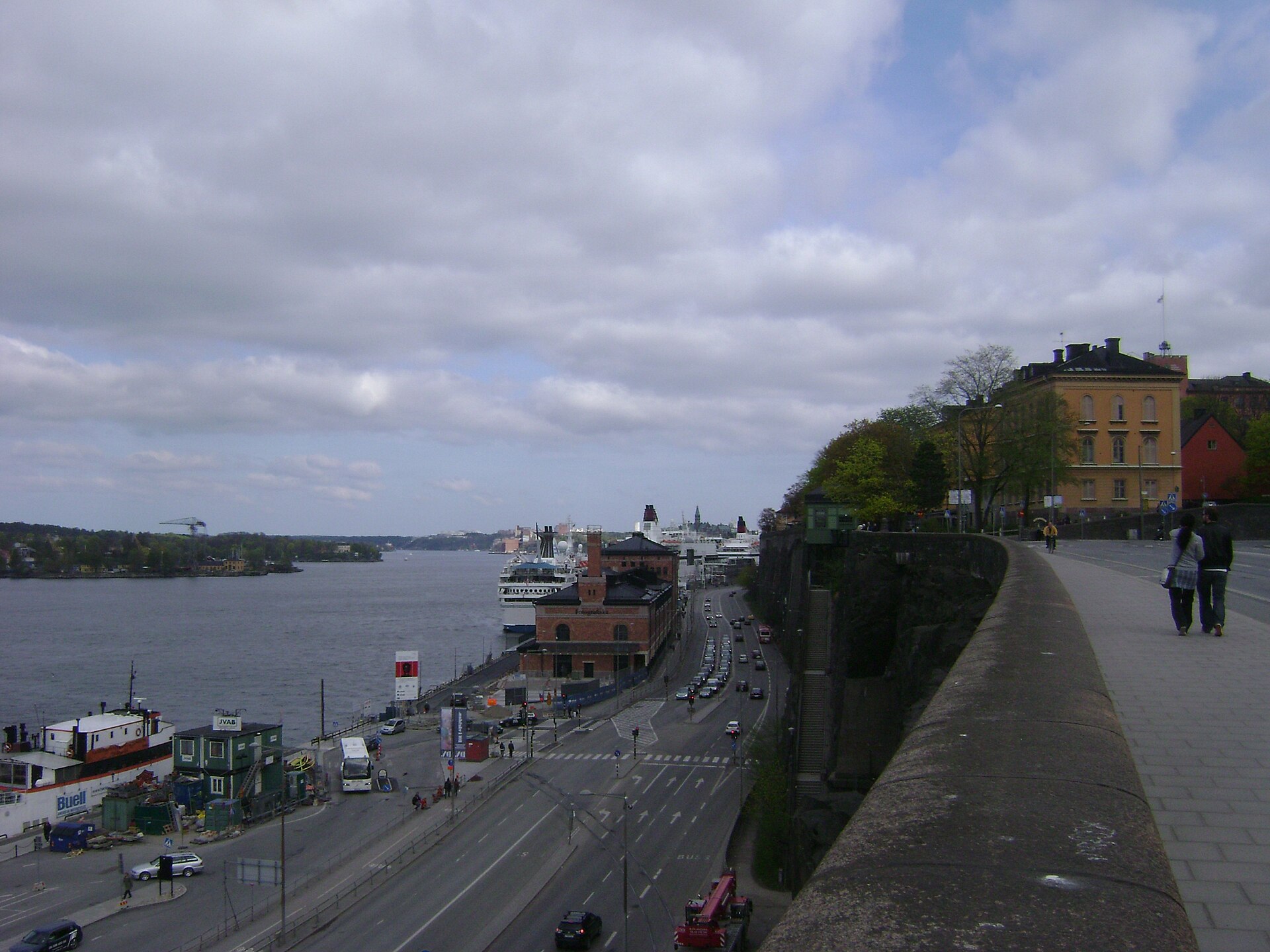
Stockholm’s oldest and most central districts sit on a cluster of islands at the point where Lake Mälaren drains into Saltsjön, the Baltic inlet that reaches into the city. The core group includes Stadsholmen (the heart of Gamla Stan), Riddarholmen, Helgeandsholmen, Kungsholmen, Södermalm, Djurgården, Skeppsholmen and Kastellholmen. The wider municipality also takes in mainland peninsulas and several further islands, so the true picture is more layered than a single number suggests.
How many islands does Stockholm actually sit on?
Official tourism material for the city, including material published by the region’s tourism organisations, commonly describes Stockholm as built across fourteen islands. That figure is a useful shorthand rather than a fixed scientific count — it depends on where the boundary of “central Stockholm” is drawn, whether small connected islets are counted separately, and whether islands belonging to neighbouring municipalities such as Lidingö are included.
What is not in dispute is the underlying geography: central Stockholm occupies a genuine archipelago threshold, not a single landmass, and this shapes almost everything about how the city is laid out, named and travelled across.
Which islands make up the historic centre?
Three islands together form what most visitors experience as Gamla Stan, Stockholm’s Old Town. Stadsholmen is the main island and the oldest settled part of the city, dating to the traditional founding year of 1252. Riddarholmen sits immediately west of it, home to Riddarholmskyrkan, the medieval church used for royal burials. Helgeandsholmen, the “Isle of the Holy Spirit,” is smaller still and holds the Riksdag, Sweden’s parliament building.
These three islands are so tightly connected by short bridges that they read as one continuous old town on foot, though administratively and historically they are distinct islands with different roles.
- Stadsholmen — the medieval core, narrow streets, Storkyrkan cathedral and Stortorget square
- Riddarholmen — the royal burial church and grand 17th-century townhouses
- Helgeandsholmen — the seat of Sweden’s national parliament
The full history of how this cluster developed is covered in a dedicated piece on Gamla Stan and how old Stockholm’s Old Town actually is, and Riddarholmen’s role as a royal burial site is explained separately in the article on why kings are buried on Riddarholmen.
Which other islands hold the rest of central Stockholm?
Beyond the old town cluster, several further islands carry major institutions and neighbourhoods that most people assume are simply “part of the city” without registering that each is a discrete piece of land surrounded by water.
- Kungsholmen — home to Stockholm City Hall, Stadshuset, where the Nobel Prize banquet is held each year
- Södermalm — the large southern island, one of the city’s most populous residential districts
- Djurgården — a former royal hunting ground now home to a dense concentration of national museums
- Skeppsholmen — a former naval island now given over largely to cultural institutions
- Kastellholmen — a small islet beside Skeppsholmen, connected by a short bridge and marked by its own flag-flying castle
- Långholmen — a small island west of Södermalm, formerly a prison, now parkland
Djurgården’s concentration of museums is unusual enough that it has its own explanation, covered in why so many of Stockholm’s museums ended up on Djurgården. Kastellholmen’s specific role as a small, separately named islet is set out in what Kastellholmen is and why it flies a flag.
Are Norrmalm, Östermalm and Vasastan islands too?
No. Despite sitting at the centre of what feels like “downtown Stockholm,” Norrmalm, Östermalm and Vasastan are on the mainland side of the city, part of a peninsula rather than separate islands. This surprises many visitors, since these districts contain Drottninggatan, Sergels Torg and Stockholm’s main shopping and business streets — areas that feel just as “central island” as Gamla Stan but are geographically continuous with the rest of the Swedish mainland to the north.
The practical effect is that Stockholm’s identity as an “island city” is concentrated in its southern and central water crossings, not spread evenly across the whole built-up area. A walk from Norrmalm into Gamla Stan crosses water and an island boundary; a walk from Norrmalm further north into Vasastan does not.
Why was the city built on islands in the first place?
Stadsholmen sits at the narrow channel where Lake Mälaren, Sweden’s third-largest lake, meets the Baltic Sea. Whoever controlled this point controlled trade and shipping movement between the agricultural interior around the lake and the sea routes beyond. Medieval Swedish sources credit Birger Jarl with fortifying the site in the mid-13th century for exactly this reason: a narrow, defensible island chokepoint at a strategic junction of water routes.
The islands that grew up around that original settlement — Riddarholmen for the nobility, Helgeandsholmen for institutions, Kungsholmen and Södermalm for expansion as the city outgrew its original footprint — were absorbed into the city over the following centuries rather than planned as a single unit from the start.
How do the islands connect to each other?
Stockholm’s islands are joined by a dense network of bridges, several of which are landmarks in their own right rather than purely functional crossings. Vasabron is one of the key links between Norrmalm’s mainland peninsula and the Gamla Stan island cluster, and its role in stitching the city’s water-divided geography together is covered in what Vasabron is and how it connects Stockholm’s islands.
At the southern edge of Gamla Stan, the Slussen junction manages the transition between Södermalm and the old town across the point where Mälaren meets the Baltic — a crossing so structurally important, and so difficult to build correctly, that it has been substantially rebuilt in the modern era. That rebuilding is explained in what Slussen is and why it has been rebuilt.
Elsewhere, ferries supplement bridges, particularly toward Djurgården and out into the wider waterways, and the metro and bus network is built around the assumption that most journeys across central Stockholm involve at least one water crossing.
Does the wider archipelago count as part of these islands?
Not in the usual sense. The “fourteen islands” figure describes the built-up city centre. The Stockholm archipelago is a separate, much larger geographic feature stretching east into the Baltic, commonly described by regional tourism and geographic sources as containing tens of thousands of islands, islets and skerries — figures in the tens of thousands are widely cited, though exact counts vary by source and by what is classified as an island versus a bare rock.
The archipelago is reachable from central Stockholm by ferry and is a genuinely distinct subject from the question of which islands the built city itself occupies. Confusing the two — assuming the “fourteen islands” of the city are the same thing as the archipelago’s islands — is a common error worth avoiding.
Why does this matter for getting around the city today?
Understanding Stockholm’s island structure explains a lot of practical, everyday texture: why certain streets end abruptly at water, why some neighbourhoods that look close together on a map require a bridge or a metro change to reach, and why viewpoints such as those covered in the articles on Fjällgatan and Monteliusvägen look out over open water rather than more city.
For anyone planning routes through the city, the general shape of the public transport system — built around zones, water crossings and interchange points rather than a simple grid — is covered in the Getting Around section. For a broader sense of how the individual districts on these islands differ from one another, the Neighbourhoods archive covers them one at a time, and major waterfront landmarks are indexed in the Landmarks & Sights archive.
Access Stockholm is an independent guide written from published, checkable sources. We have not visited the places described here and we do not publish personal recommendations or invented ‘local favourites’ — where something is singled out as notable, we say who says so. Opening times, fares, closures and prices change at short notice, so treat everything here as a starting point and confirm with the museum, operator or venue directly before building a day around it. We give no advice on visas, insurance, health or safety; use your own government’s official guidance for those.
Featured image: Photo by Zairon, source, CC BY-SA 3.0
