Hammarby Sjöstad is a district built from the mid-1990s onward on former industrial and harbour land south of Södermalm, around a lake called Hammarby Sjö. It was built to prove that a dense new city district could run its waste, water, heating and energy as one linked system, cutting its environmental impact well below that of an ordinary 1990s neighbourhood.
Where is Hammarby Sjöstad, exactly?
The district sits immediately south-east of Södermalm, wrapped around the shores of Hammarby Sjö, a lake-like basin that opens into the Baltic side of central Stockholm’s waterways. Its western edge is near Danvikstull; it extends east through Luma and Sickla toward the boundary with Nacka municipality. Most of the district lies within the City of Stockholm; the eastern fringe crosses into Nacka.
It is not one of Stockholm’s historic core islands. Where districts like Riddarholmen or Kastellholmen occupy small, fixed landmasses, Hammarby Sjöstad is mainland shoreline reshaped by industry and then by planners — a different kind of geography from the archipelago pattern covered in the site’s overview of which islands Stockholm is actually built on.
What was on this land before the district was built?
Hammarby Sjö itself is not fully natural in its current form. In the 1920s, the Hammarbyleden canal was cut through to link the basin directly to Saltsjön, shortening the shipping route through the city and turning what had been a bay into a through-channel. For most of the 20th century the shoreline around it carried gasworks, sawmills, shipyards, container handling and other heavy industry, along with contaminated ground that later had to be remediated before housing could go in.
By the early 1990s much of this industrial activity had wound down, leaving the city with a large, centrally located but heavily used stretch of waterfront in need of a purpose. That gap is the direct reason the district exists at all.
Why does Hammarby Sjöstad exist — what was the Olympic connection?
Stockholm bid to host the 2004 Summer Olympics, and the plan submitted to the International Olympic Committee proposed the Hammarby Sjö shoreline as the site of the Olympic Village. The IOC awarded the 2004 Games to Athens in 1997, and Stockholm’s bid did not proceed.
The City of Stockholm went ahead with redeveloping the site as ordinary housing regardless, but the Olympic bid had already forced detailed planning of the land, and the city used that momentum to attach an explicit second objective to the project: turning it into a demonstration district for environmental infrastructure, rather than just another residential extension of Södermalm.
What is the “Hammarby model,” and what was it meant to prove?
The Hammarby model — Hammarbymodellen — is the name given to the integrated system linking waste, water, sewage and energy across the district, as documented in the City of Stockholm’s own planning and environmental material for the project. The stated aim, set out in that documentation, was to roughly halve the environmental load of the district compared with a typical Swedish neighbourhood built to 1990s standards.
The mechanics, as described by the City of Stockholm and by Stockholm Vatten och Avfall, the municipal water and waste utility, work roughly like this:
- Household waste is sorted at source and collected partly through underground vacuum chutes rather than truck rounds, reducing traffic through residential streets.
- Treated wastewater passes through a local treatment works where residual heat is extracted and fed into district heating before the water is discharged.
- Organic waste is processed to produce biogas, used locally for heating, cooking and as vehicle fuel.
- District heating and cooling are distributed as a shared network rather than building by building.
The city ran an information point, GlashusEtt, in the district specifically to explain this infrastructure to visitors and delegations; its current opening status should be checked directly before planning a visit, since exhibition spaces of this kind change hours or close without much notice.

How is the district connected to the rest of Stockholm?
Hammarby Sjöstad was built without a metro station, a deliberate choice tied to the environmental brief: the district relies instead on Tvärbanan, the cross-city tram line run within the SL public transport network, along with bus routes and a small passenger ferry that crosses Hammarby Sjö to link the two shores. The intention, set out in the city’s own planning documents, was to make walking, cycling and surface public transport the default rather than the car — general background on how the wider system of trams, buses and the metro fits together sits in the site’s Getting Around archive. The district connects north-west into central Stockholm past the area around Slussen, and sits close to landmarks such as the Avicii Arena near Gullmarsplan.
What does the district actually look like?
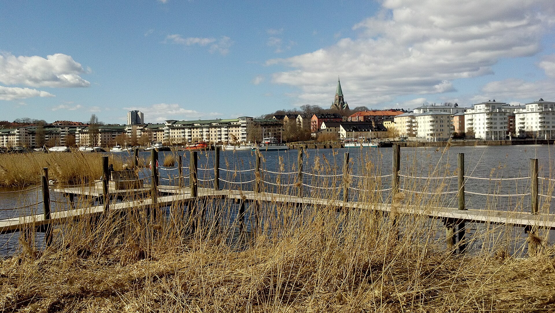
Hammarby Sjöstad reads as continuous, mid-rise construction: blocks of roughly five to eight storeys, built close to the water with glazed balconies facing the lake and quieter courtyards behind. The architecture is consistently contemporary — there is no historic core here to preserve, unlike in Gamla Stan or on Riddarholmen — and the shoreline itself was engineered as public promenade rather than working harbour, a deliberate reversal of what the land was used for a century earlier.
Housing here is overwhelmingly apartments, mostly built for private ownership and rental in roughly equal mixes across different blocks, following the tenure patterns typical of new-build Stockholm districts of this period.
Is Hammarby Sjöstad finished?
Not entirely. Construction has proceeded in phases from the mid-1990s through the 2010s, and the City of Stockholm has continued extending development north and south of the original core, including areas referred to in city planning as Hammarby Sjöstad Norra and adjoining Söderstaden work near Gullmarsplan. Figures for total population and number of homes are best treated as moving targets and checked against current City of Stockholm planning pages rather than taken from any fixed number, since the district has grown in stages well beyond its original 1990s footprint.
What has the model actually proven?
Hammarby Sjöstad has been widely cited — by the City of Stockholm itself, by Swedish research institutions and by international urban planning bodies — as a working case study in integrated eco-district infrastructure, and delegations from other cities have visited it specifically to study the waste, water and heating linkages. That international attention is itself part of the record, regardless of how the district functions day to day for residents.
Independent academic assessments, referenced in Swedish research literature on the project, have also noted that the district did not fully meet its original environmental targets on every measure, and that some of the technical systems — particularly the vacuum waste chutes — proved more expensive to operate than modelled. Readers weighing how well the model performed should treat that as a genuinely contested question with sources on both sides, rather than a settled verdict either way.
What is not contested is the underlying shift the district represents: a piece of Stockholm’s industrial waterfront, unusable for housing without cleanup, repurposed as a test of whether infrastructure itself — not just architecture — could be designed to lower a neighbourhood’s footprint. That is the specific thing Hammarby Sjöstad was built to demonstrate, separate from whatever the Olympics would have added to it.
Is it useful to compare with other Stockholm districts?
Yes, mainly by contrast. Where Östermalm and Vasastan were laid out on 19th-century grid plans for a growing bourgeois city, and Norrmalm was substantially rebuilt in the mid-20th century for commerce and traffic, Hammarby Sjöstad is a late-20th and early-21st-century project with an explicit, written environmental brief attached from the start. That makes it one of the few Stockholm districts where the planning objective is as much a part of the story as the streets themselves — background that sits alongside broader material on how the city’s neighbourhoods took shape in the Neighbourhoods archive and the wider guide to living in Stockholm. Anyone planning transport or a day’s route through the southern waterfront may also want the general orientation in the practical Stockholm hub.
Access Stockholm is an independent guide written from published, checkable sources. We have not visited the places described here and we do not publish personal recommendations or invented ‘local favourites’ — where something is singled out as notable, we say who says so. Opening times, fares, closures and prices change at short notice, so treat everything here as a starting point and confirm with the museum, operator or venue directly before building a day around it. We give no advice on visas, insurance, health or safety; use your own government’s official guidance for those.
Featured image: Photo by Arikogan, source, CC BY-SA 3.0
