Djurgården is an island of protected parkland in central Stockholm — a former royal hunting ground of forest, meadow and shoreline that happens to also hold a cluster of major museums. The buildings are recent additions to a landscape that has been managed as crown land, and now as part of a national park, for far longer than any of them have existed.
Where does the name Djurgården come from?
“Djurgården” translates roughly to “animal enclosure” or “deer park” — djur means animal, gård here means enclosed ground. The name describes exactly what the place was: Swedish kings used the island as a royal hunting ground from the 16th century onward, stocking it with deer and restricting access to the crown and its guests. That history is the reason the land was never carved up for building in the way most of central Stockholm was. It stayed crown property, managed as a single tract, long after the hunting stopped.
What is the Royal National City Park, and how does Djurgården fit into it?
Djurgården is one section of the Kungliga Nationalstadsparken — the Royal National City Park — an area the Swedish Riksdag designated by law in the mid-1990s, covering Djurgården along with Haga, Ulriksdal and the Brunnsviken shoreline further north. It was, at the time, described as the first legally protected national urban park of its kind. The designation restricts new building and protects the tree cover, sightlines and open water within its boundary, regardless of who owns a given plot.
That legal status is the clearest answer to what Djurgården “is”: not a neighbourhood zoned for development like Östermalm or Kungsholmen, but a protected landscape that a museum, a funfair or a royal residence happens to sit inside.
Who owns and manages the land?
Most of Djurgården remains crown land, administered day to day by Kungliga Djurgårdens Förvaltning (the Royal Djurgården Administration), which operates under Statens fastighetsverk, Sweden’s National Property Board. This body manages the forestry, the grazing meadows, the paths and the leases held by institutions on the island — including the museums that draw most visitors there. It is a landholder and land manager first, and only incidentally a museum operator.
What does the parkland actually contain, beyond the museums?
Strip away the buildings and Djurgården is oak forest, open pasture, formal avenues and a network of canals and inlets. Notable elements include:
- Old-growth oak stands, some of the trees several centuries old, protected as habitat for insects and birds that depend on aging oak.
- Grazing meadows kept open by cutting and livestock, a management method typical of traditional Swedish pastureland rather than an ornamental city park.
- Rosendals Trädgård, a working biodynamic garden and nursery on the island, run as a horticultural operation rather than a museum.
- Galärparken, an open lawn and waterside area near the entrance to the island, used for public gathering and events.
- Djurgårdsbrunnsviken and the Djurgården canal, the water bodies that separate and border the island, used for rowing, sailing and, in hard winters, ice skating.
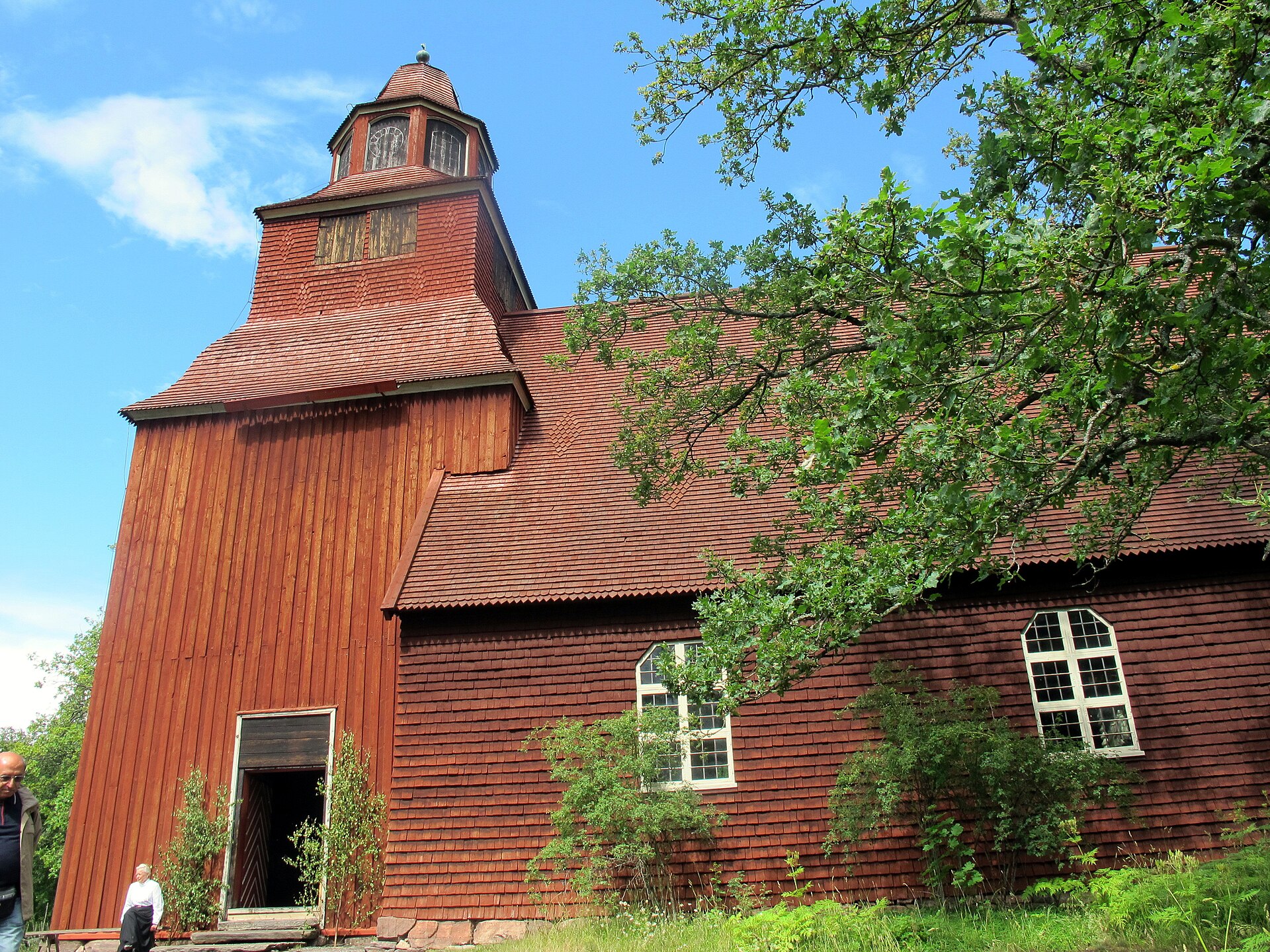
Skansen, widely known as an open-air museum, is itself partly this kind of landscape management — it maintains grazing Nordic livestock and reconstructed farm buildings on managed pasture, which sits closer to the park’s own logic than to a conventional museum collection.

How do you get onto Djurgården, and does allemansrätten apply?
Djurgården connects to Östermalm by the Djurgårdsbron bridge and is reachable on foot, by bicycle, by tram, and by the passenger ferries that cross from Slussen and from Nybroplan — a route covered in detail on this site’s page on the Djurgården ferry network. There is no vehicle toll or entry barrier; it functions as an extension of the city’s walkable core rather than a gated estate.
Sweden’s right of public access, allemansrätten, generally allows walking, cycling and short-stay recreation on uncultivated land, but Djurgården is managed crown parkland with cultivated gardens, protected meadows and leased institutional plots, so the practical rules on the ground — where to walk a dog, where planting is protected, what the Royal Djurgården Administration posts locally — take precedence over the general right described on this site’s page on allemansrätten.
How does the park change through the year?
Djurgården is used differently by season. Spring brings the flowering of the island’s fruit trees and the reopening of Rosendals Trädgård’s growing season; summer brings rowing, open-air concerts on Galärparken’s lawn and heavy foot traffic tied to the museums; autumn brings the oak canopy’s colour change, which the National Property Board’s own conservation material treats as ecologically significant, not just scenic; winter, when cold enough, can bring skating on the canal and cross-country ski tracks laid on the open meadows. None of this is guaranteed on any given date — Stockholm’s winters vary in severity, a subject covered on this site’s page on how cold a Stockholm winter actually is — but the pattern of seasonal use is consistent.
How does Djurgården work for residents compared with visitors?
For a visitor, Djurgården usually means a short list of institutions reachable on one ticket or one afternoon. For a resident, it functions closer to a working city park: a place to run, cycle, walk a dog, row on the canal, or spend an unstructured Sunday on open grass without paying to enter a building. Stockholmers use it the way Londoners use Hyde Park or Parisians use the Bois de Boulogne — as recreational ground that happens to be historically loaded, rather than as a single attraction to be checked off. A dedicated route through the island’s paths and open ground is set out in this site’s walking route across Djurgården, and the wider question of how the city’s green spaces fit together is covered in the Parks & Archipelago section.
How does this compare with Djurgården’s reputation as a museum district?
The museum concentration is real and well documented — this site covers the reasons several of Sweden’s largest institutions ended up on one island in a separate piece on why Stockholm’s museums cluster on Djurgården, and the individual collections are catalogued across the Museums & Galleries archive. But the museums are tenants on protected crown parkland, not the reason the parkland exists. The hunting ground came first, by roughly four centuries; the national park designation formalised the protection in law; the museums arrived afterward, drawn by the same open, managed land that keeps the rest of the island free of construction. Reading Djurgården only as a museum row misses the larger and older fact: it is one of the few places in central Stockholm where land use has stayed, deliberately, almost unchanged.
For planning a visit around both the parkland and its institutions, the practicalities of getting across the city — trams, ferries, walking distances — are laid out in the site’s Getting Around archive, and broader questions about fitting green space into a short stay are addressed in Stockholm Practical.
Related reading
what the city is like to actually live in, The Stockholm Guide, Can You Swim in Central Stockholm? What Changed, What Is Nackareservatet? Stockholm’s Forest Nature Reserve
Access Stockholm is an independent guide written from published, checkable sources. We have not visited the places described here and we do not publish personal recommendations or invented ‘local favourites’ — where something is singled out as notable, we say who says so. Opening times, fares, closures and prices change at short notice, so treat everything here as a starting point and confirm with the museum, operator or venue directly before building a day around it. We give no advice on visas, insurance, health or safety; use your own government’s official guidance for those.
Featured image: Photo by kallerna, source, CC BY-SA 4.0
