Kungsholmen is an island and administrative district in central Stockholm, sitting west of Norrmalm and Vasastan, north of Riddarfjärden. It is mostly residential — apartment blocks rather than monuments — but its eastern tip carries Stockholm City Hall, and the whole island is served by its own stretch of the metro’s blue line.
Where does Kungsholmen sit in Stockholm’s geography?
Kungsholmen is one of the islands that make up central Stockholm, alongside Norrmalm, Södermalm, Djurgården and Gamla Stan. It is bounded by Riddarfjärden to the south and east, and by narrower waterways — Karlbergssjön and the channels around Barnhusviken — to the north and east, where bridges carry it into Norrmalm and Vasastan. The city’s own account of which islands Stockholm is actually built on places Kungsholmen among the handful of islands that form the historic core, distinct from the archipelago districts further out.
Several bridges connect it to the rest of the city: Kungsholmsbron and Barnhusbron link it to Norrmalm and Vasastan, and Västerbron — a long steel-arch bridge completed in 1935 — carries traffic across Riddarfjärden to Södermalm. That bridge sits alongside others discussed in the site’s piece on how Stockholm’s islands connect, which covers the logic of the bridge network more generally.
Why is Stockholm City Hall on Kungsholmen?
Stockholm City Hall (Stadshuset) stands on the eastern tip of Kungsholmen, on a promontory called Kungsholms strand, chosen in the early twentieth century for its waterfront position facing Riddarfjärden and Gamla Stan across the water. It was designed by the architect Ragnar Östberg and completed in 1923.
The building houses the offices of Stockholm’s municipal government and two ceremonial halls open to the public on guided tours run by the City of Stockholm: the Blue Hall (Blå hallen), where the Nobel Banquet is held each December, and the Golden Hall (Gyllene salen), decorated with gold mosaic. The site’s dedicated article on what happens at Stockholm City Hall covers the council chamber, the tower, and how the tours and tower climb are organised.
What was Kungsholmen like historically?
The name translates roughly as “the King’s islet,” reflecting crown ownership from the seventeenth century, when the island was largely undeveloped land outside the fortified city on Gamla Stan. Through the 1700s and 1800s it developed an industrial character — shipyards, breweries, tanneries and workshops — and housing for the workers who staffed them, giving it a reputation as one of Stockholm’s poorer, more crowded districts well into the twentieth century.
That changed with a large-scale rebuilding programme in the 1920s to 1940s, when much of the old low-rise housing was cleared and replaced with the functionalist apartment blocks that still define most of the island. The pattern parallels what happened across the water: the site’s article on what Norrmalm is and what was rebuilt there describes a comparable twentieth-century transformation of an older, denser district into planned modern blocks.
What does Kungsholmen look like today?
Kungsholmen today is administered as one of Stockholm’s official city districts (stadsdelsområden) and functions largely as a residential and administrative quarter rather than a visitor destination. Alongside City Hall, it hosts a concentration of public institutions: Stockholm’s district court sits in a building on Scheelegatan near the Rådhuset metro station (rådhus meaning courthouse, the source of that station’s name), and the Stockholm Police Authority’s headquarters is also on the island, on Kungsholmsgatan.
The built environment is dominated by early-to-mid twentieth-century apartment buildings, generally four to six storeys, arranged in a grid that is denser near Fridhemsplan and looser toward the western end of the island around Kristineberg and Stadshagen.
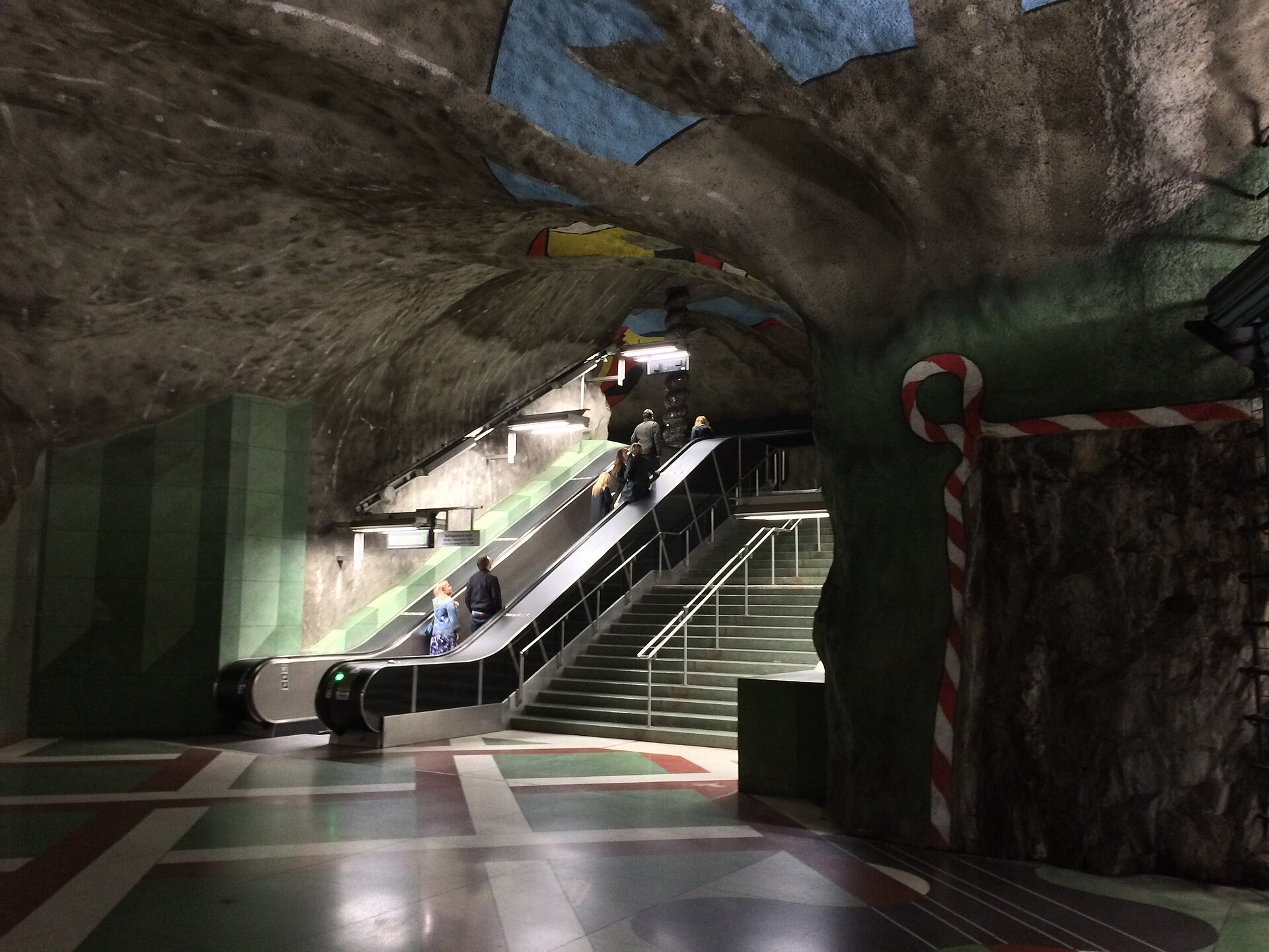
.jpg)
How do you get around Kungsholmen?
Kungsholmen is served directly by three stations on the Tunnelbana’s blue line: Fridhemsplan, Rådhuset and Stadshagen. Fridhemsplan is also a stop on the green line, making it one of the busier interchange points in the network away from the central hub. Central Station and T-Centralen lie just across the water in Norrmalm, a short walk or one stop away.
Bus routes cross the island on surface streets, and Norr Mälarstrand — the waterfront promenade along the island’s southern shore facing Riddarfjärden — is a walking and cycling route connecting toward Gamla Stan on one side and Västerbron on the other. General patterns for navigating the network, including how zones and travel cards work, are covered in the site’s Getting Around archive.
What is there to see or do on Kungsholmen?
Beyond City Hall, the island’s best-known public space is Rålambshovsparken, a large waterfront park on the southern shore used for outdoor recreation and open-air events in summer, and Norr Mälarstrand, the promenade running along Riddarfjärden with views across to Södermalm and Gamla Stan. The island has no major museum of its own; visitors typically pass through it on the way to or from the sights concentrated in Norrmalm and Gamla Stan, or specifically to see City Hall and its tower. Broader context on how the city’s museums and landmarks are distributed across its islands is in the site’s guide to Stockholm’s museums, landmarks and neighbourhoods.
Is Kungsholmen a good place to live?
Kungsholmen functions as a largely residential, family-oriented district — quieter and more administrative in character than the nightlife-heavy stretches of Södermalm or the shopping streets of Östermalm, both covered in the site’s own district explainers on Södermalm and Östermalm. Its housing stock is dominated by owner-occupied and rental apartments in the interwar and postwar blocks built after the district’s redevelopment, with fewer of the older, subdivided buildings found in parts of Södermalm.
Daily life on the island centres on Fridhemsplan’s shops and services, the waterside parks along Riddarfjärden, and quick transit access into the rest of the inner city. For a wider view of how Stockholm’s districts differ in practical, everyday terms — schooling, transport, seasonal rhythm — the site’s hub on living in Stockholm sets Kungsholmen’s residential character against the rest of the inner city, and the Neighbourhoods archive collects the district-by-district detail in one place.
Access Stockholm is an independent guide written from published, checkable sources. We have not visited the places described here and we do not publish personal recommendations or invented ‘local favourites’ — where something is singled out as notable, we say who says so. Opening times, fares, closures and prices change at short notice, so treat everything here as a starting point and confirm with the museum, operator or venue directly before building a day around it. We give no advice on visas, insurance, health or safety; use your own government’s official guidance for those.
Featured image: Photo by Николай Семёнов, source, CC BY 3.0
.jpg)