The Royal National City Park — Kungliga Nationalstadsparken in Swedish, often shortened to Nationalstadsparken or nicknamed Ekoparken — is a legally protected band of parkland, water and forest that runs through Stockholm, Solna and Lidingö. It was created by an act of the Swedish parliament in 1995, the first designation of its kind anywhere in the world, and it exists to stop the green wedge between the city centre and its northern suburbs from being built over.
What does “national city park” actually mean?
It is a planning and conservation status, not a single fenced park with gates. The designation restricts development and requires that the area’s parkland, waterways, historic buildings and tree cover be preserved as a connected whole, rather than treated as separate sites to be developed piecemeal.
The law that created it — passed by the Riksdag in 1994 and taking effect in 1995 — was later folded into Sweden’s Environmental Code, which sets out that construction and other interventions inside the park’s boundary must not damage its natural or cultural values. Municipalities still own and manage the land within their own borders; the national designation sits on top of that as a constraint on what can be done with it.
Where does the park actually run?
It stretches roughly nine kilometres from Ulriksdals slott in the north, through Hagaparken and around the bay of Brunnsviken, down through parts of Norra Djurgården and central Djurgården, and out to the small islands of Fjäderholmarna in the archipelago to the east. Along the way it crosses three municipalities — Stockholm, Solna and Lidingö — which is one reason it needed a national law rather than a single city ordinance to hold together.
Within that band sit some of the most recognisable green spaces in the region, including Hagaparken, the royal park associated with the 18th-century plans of Gustav III, and Djurgården, better known to visitors for its museums than for the oak woodland and grazing land that surrounds them. The park is best understood as a corridor connecting these pieces of older royal and civic land into one continuous, legally defended stretch.
Why was it created in the first place?
It was created in response to specific development pressure in the 1980s and early 1990s, when proposals for new roads and buildings threatened to cut through parkland that had, until then, been protected only piecemeal, park by park. A public campaign — backed by environmental groups, historians and residents — argued that the area’s value came from its continuity, not from any one site within it, and that continuity needed a single legal status to survive.
Parliament agreed, and the result was a designation that treats roughly 27 square kilometres of land and water as one entity for planning purposes, regardless of which municipality administers a given stretch of it on the ground.
What is actually protected inside the boundary?
The park is not empty countryside. It contains royal palaces, 18th and 19th-century pavilions, oak forest that in places predates the city itself, naval history sites, allotment gardens, and open water including Brunnsviken and parts of Saltsjön. Its layers of history run from medieval hunting grounds through royal landscaping to 20th-century public parkland.
- Historic buildings and royal-era landscaping, including Ulriksdals slott and the pavilions of Hagaparken.
- Some of the oldest and largest stands of oak in the Stockholm region, ecologically significant because old oak supports insect and bird species that newer plantings do not.
- Museum grounds on Djurgården, where the buildings sit inside — but are legally distinct from — the protected parkland around them.
- Shoreline and water, including Brunnsviken bay and the approach to the archipelago at Fjäderholmarna.
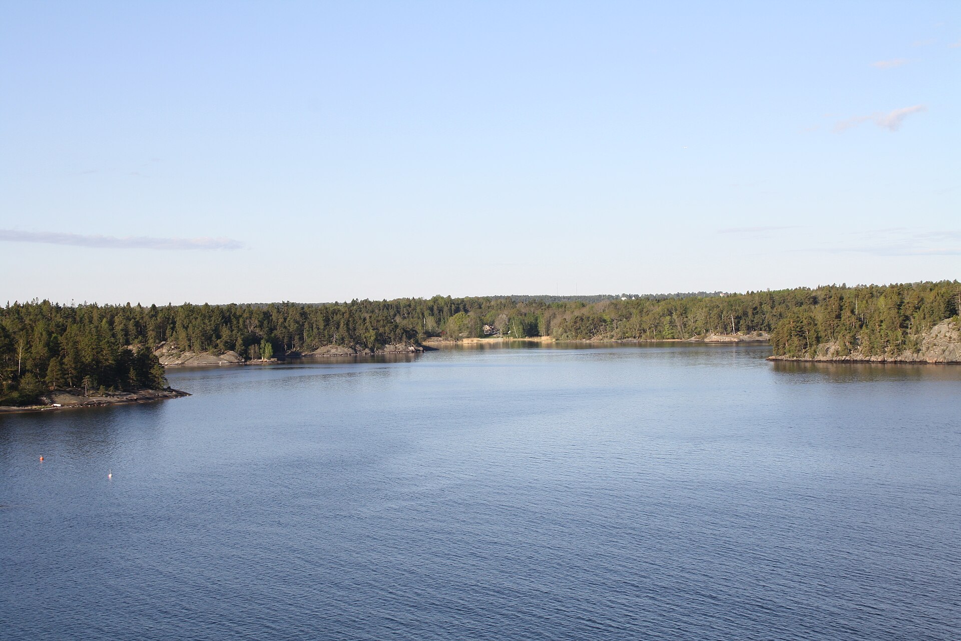
_(Kenny_McFly).jpg)
How is this different from an ordinary city park?
An ordinary municipal park is managed and can, in principle, be reduced, redesigned or partly built on by the municipality that owns it, subject to normal planning rules. The Royal National City Park sits under a stricter, national-level protection specifically because it spans several municipalities and was judged too easily eroded piece by piece otherwise.
In practice this means proposals for new buildings, roads or major infrastructure within the boundary face a higher bar than they would outside it, and the law requires that decisions account for the area’s landscape and history as a whole, not just the plot in question. This is different in kind from the protection given to a single park such as Tantolunden on Södermalm, which is significant locally but does not carry the same cross-municipal legal status.
Can you visit “the park” as a single place?
Not in the way you would visit a museum or a single garden. There is no central entrance, no ticket, and no one route that covers it. What exists on the ground are the individual parks, woodlands and shorelines that the designation stitches together — Hagaparken, the Djurgården shoreline, Ulriksdal, Fjäderholmarna — each accessible on its own terms, mostly on foot, by bicycle or by public transport, and free to enter.
A walk that crosses part of the protected area without naming it as such is described in a walking route across Djurgården, which covers ground that is technically within the Royal National City Park boundary even though most visitors experience it simply as Djurgården’s paths and museum grounds.
General access to green and forested land in Sweden, inside or outside a protected park, is also shaped by allemansrätten, the right of public access that lets people walk, cycle and picnic on land they do not own, within limits.
Does the designation affect ordinary life in Stockholm?
Yes, mostly by absence: it is one reason the green corridor between central Stockholm and its northern suburbs has not been filled in with housing or road infrastructure over the past three decades, despite recurring development pressure and a growing regional population. Debates over specific projects at its edges — road tunnels, new buildings near its boundary, changes to Djurgården’s museum sites — regularly test how strictly the protection is interpreted, and those debates are a fixture of local planning politics rather than a settled, closed question.
For residents, the practical effect is a continuous stretch of accessible woodland, water and historic parkland reachable from several parts of the city without a long journey out — one of the reasons Stockholm’s relationship with green space is different from that of most European capitals of comparable size.
Who manages and oversees it today?
Oversight is shared. The county administrative board — Länsstyrelsen i Stockholms län — has a formal role in monitoring the designation and advising on developments that might affect it, while day-to-day management of individual parks and buildings within the boundary remains with whichever municipality, royal agency or institution owns that particular piece of land. There is no single management office for the park as a whole; its coherence is legal rather than administrative.
Readers wanting the underlying legal detail can consult Länsstyrelsen Stockholm’s own material on Nationalstadsparken, which sets out the boundary and the specific protections in more detail than is useful to reproduce here.
How does this fit into a visit or a longer stay?
Most people encounter pieces of the Royal National City Park without ever needing to know the designation exists — a walk through Hagaparken, an afternoon on Djurgården, a ferry past Fjäderholmarna. Knowing the legal status mainly explains why those pieces feel connected rather than isolated, and why so much open water, oak forest and 18th-century landscaping has survived this close to a capital city centre.
For planning an actual visit to any one part of it, the more useful starting points are the individual guides to those places, along with the broader parks and archipelago coverage and the landmarks and sights archive, which cover the buildings and museum sites that sit inside the park’s boundary in more practical detail. Anyone mapping how this fits against the rest of the city’s districts can also start from the neighbourhoods archive.
Access Stockholm is an independent guide written from published, checkable sources. We have not visited the places described here and we do not publish personal recommendations or invented ‘local favourites’ — where something is singled out as notable, we say who says so. Opening times, fares, closures and prices change at short notice, so treat everything here as a starting point and confirm with the museum, operator or venue directly before building a day around it. We give no advice on visas, insurance, health or safety; use your own government’s official guidance for those.
Featured image: Photo by Kenny McFly, source, CC BY-SA 3.0
_(Kenny_McFly).jpg)