T-Centralen is Stockholm’s central metro station, sitting beneath Norrmalm in the middle of the city. It is the only point in the network where all three tunnelbana (metro) lines — red, green and blue — physically meet, and it connects directly to Stockholm’s main railway station above ground. The name is short for “Tunnelbana Centralen”.
What exactly is T-Centralen?
T-Centralen is the hub station of Stockholm’s metro system, run by SL (Storstockholms Lokaltrafik), the regional public transport authority. It is not a single platform but a cluster of connected station halls carved into the rock beneath central Norrmalm, linking the red, green and blue lines with each other and with Stockholm Central Station (Stockholm C) on the surface.
It functions as the interchange for a city where nearly every cross-town metro journey passes through, or near, this point. For a resident, it is the station most likely to appear in a daily commute even if neither the origin nor the destination is nearby. For a visitor, it is usually the first metro station encountered, arriving from the airport train or a regional train into Stockholm C.
Which metro lines actually meet at T-Centralen?
All three of Stockholm’s tunnelbana lines call at T-Centralen: the red line, the green line and the blue line. It is the single station in the system where every line intersects, which is what makes it the de facto centre of the whole network.
The red line and green line share one set of platforms; the blue line has its own, separate platforms elsewhere in the complex. This matters for how the station is laid out, and it is the reason first-time users sometimes find T-Centralen confusing rather than simply large.
Why does the station have two separate halls, not one?
T-Centralen was built in phases, and the red/green platforms and the blue platforms were constructed as distinct works, connected afterwards by passages and escalators rather than built as a single continuous space. The red and green line hall opened in stages from the late 1950s as the tunnelbana’s original central section was completed; the blue line hall opened later, in the mid-1970s, as a new, deeper line running further out.
The result is that a passenger changing between, say, the red line and the blue line is not stepping across a platform but walking through a connecting corridor between two separate underground stations that share a single name and a single fare gate system. SL’s own network maps show the layout, and it is worth checking these before a change with luggage or a tight connection.

How is T-Centralen connected to Stockholm Central Station?
T-Centralen sits directly beneath Stockholm Central Station, the city’s main railway terminus, and the two are linked by underground passages, so a passenger can move from a mainline or airport train to any metro line without going outside. Stockholm C is the terminus for SJ’s national and international trains and for the Arlanda Express airport rail link, among other regional services.
Cityterminalen, the long-distance and airport bus terminal, sits immediately alongside as well, making the whole cluster — rail, bus and metro — a single connected transport node rather than three separate buildings that happen to be near each other. This is one reason T-Centralen, rather than any single line’s terminus, functions as the practical centre of Stockholm’s transport map.
Why is part of the station covered in blue and white patterns?
The blue line hall at T-Centralen is decorated with a continuous blue-and-white painted design across the rough-cut rock walls and ceiling, created by the Swedish artist Per Olof Ultvedt as part of the blue line’s construction in the 1970s. The unfinished rock surface is left visible, with the artwork following its natural contours rather than sitting on a flat wall.
T-Centralen’s blue hall is one of the most photographed examples of the wider practice of commissioning permanent art for tunnelbana stations, a policy that runs across dozens of stations in the network and is discussed in more detail in why the Stockholm metro is sometimes called the world’s longest art gallery. The red and green line hall at T-Centralen, by contrast, is far plainer, which is a useful visual cue for telling the two halls apart while inside them.
How busy is T-Centralen, and what does that mean for a rider?
SL identifies T-Centralen as the busiest station in the tunnelbana network, reflecting its role as the interchange point for all three lines and its direct link to the mainline railway. Passenger volumes and current operating figures change and are published by SL directly, so anyone wanting a specific number should check SL’s own site rather than rely on a fixed figure here.
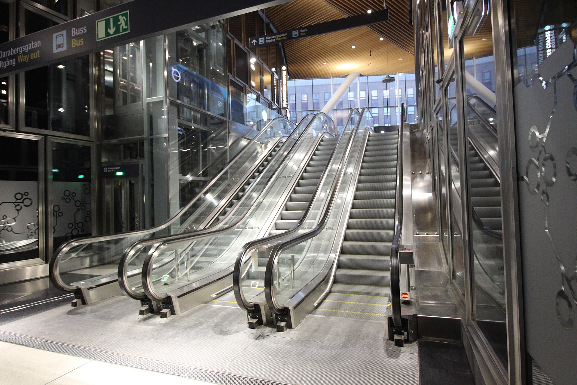
In practice, this means T-Centralen has more escalators, more signage, and considerably more walking between platforms than a typical interchange elsewhere in the network. During peak commuting hours the connecting passages between the red/green hall and the blue hall carry heavy pedestrian flow, and SL periodically closes individual escalators or stairwells for maintenance, which is worth allowing time for if a connection is tight.
How do the fare zones and travel cards work through T-Centralen?
T-Centralen sits within Stockholm’s central fare zone, and changing lines within the station does not require exiting the fare-paid area or tapping again, provided the change is made inside the gates. The wider zone and pricing structure is set by SL and explained in full in Stockholm metro zones and fares: how the system works.
Most residents and longer-stay visitors use a rechargeable SL Access card or the SL app rather than paying per journey, and how that card behaves across metro, bus and ferry is covered separately in how the Stockholm travel card works across transport. Fares, zone boundaries and card products change periodically, so current prices should always be checked on SL’s own site rather than assumed from older figures.
What is above ground at T-Centralen?
T-Centralen sits under Sergels Torg and the surrounding streets of Norrmalm, Stockholm’s rebuilt commercial core. Sergels Torg itself, the sunken square with its distinctive glass obelisk, sits directly above part of the station complex and is covered in what Sergels Torg is, and why it looks like that.
Drottninggatan, one of the city’s principal pedestrian shopping streets, runs close by and is described in what Drottninggatan is, Stockholm’s main street explained. The wider district these streets belong to, including how much of central Norrmalm was rebuilt in the mid-20th century alongside the metro’s construction, is explained in what Norrmalm is, and what was rebuilt there.
Is T-Centralen worth stopping to look at, rather than just passing through?
T-Centralen is functionally a transfer point rather than a destination, but the blue line’s cavern art is a recognised piece of public art in its own right and can be seen without leaving the fare-paid area on a valid ticket. Anyone planning a wider look at the network’s decorated stations should treat T-Centralen as one stop on a longer route rather than the whole of it — several other stations further out carry more elaborate individual schemes.
For a broader sense of how the whole system fits together — lines, zones, ticketing, and which stations reward a detour — the Getting Around archive and the practical planning hub both cover the network beyond this single interchange. Current line maps, service alerts and fare tables are maintained directly by SL and should be checked on their own site before travelling.
How does T-Centralen fit into the rest of the city, structurally?
T-Centralen was built as the meeting point precisely because Norrmalm is Stockholm’s central business and shopping district, sitting on the mainland rather than one of the older island districts further south and east. How the city’s administrative and geographic pieces relate to each other more broadly — which districts sit where, and how the inner city differs from the suburbs the metro lines fan out into — is set out in how Stockholm is divided administratively and Stockholm inner city versus suburbs: what’s the difference.
For a resident, understanding T-Centralen’s structure — two halls, one shared fare area, heavy peak-hour flow — is mostly about planning connection time rather than novelty. For a visitor arriving by train or airport link, it is simply the first and most direct route into the rest of the city, and the starting point most guides to central Stockholm assume without spelling out.
Access Stockholm is an independent guide written from published, checkable sources. We have not visited the places described here and we do not publish personal recommendations or invented ‘local favourites’ — where something is singled out as notable, we say who says so. Opening times, fares, closures and prices change at short notice, so treat everything here as a starting point and confirm with the museum, operator or venue directly before building a day around it. We give no advice on visas, insurance, health or safety; use your own government’s official guidance for those.
Featured image: Photo by AleWi, source, CC BY-SA 4.0
