The Stockholm archipelago is the belt of islands, islets and bare rocks that runs east from the city into the Baltic Sea. It is not a single destination but a graded landscape: built-up islands close to the city centre, working fishing villages further out, and uninhabited skerries at the edge, where the water opens onto open sea. Estimates of its scale vary by how strictly “island” is defined, but every serious count runs into the thousands.
What exactly counts as “the archipelago”?
It is the whole chain of land in the water east of Stockholm, from islands large enough to have year-round residents, roads and ferry terminals, down to skerries too small to name. Sweden’s own definition of an island — any piece of land surrounded by water that has not been artificially joined to the mainland by a bridge or causeway — is deliberately loose, which is part of why total counts differ.
How many islands are there?
The figure most often used by regional bodies, including Skärgårdsstiftelsen i Stockholms län (the Stockholm Archipelago Foundation, which manages nature reserves across the area), is that there are around 30,000 islands, islets and rocks in total. Only a small fraction of these are large enough to be inhabited or to appear on a ferry timetable — most are skerries with no buildings and no regular access.
That number should be read as an order of magnitude rather than a census. Different counting methods — including or excluding rocks that vanish under high water, for instance — can shift the total by thousands. What is not in dispute is the shape of the place: a very large number of small, low, granite islands, thinned out steadily the further east you travel.
How far does the archipelago actually stretch?
From the edge of central Stockholm to the outermost skerries, where the Baltic opens up and land effectively runs out, is commonly given as roughly 60 kilometres. Running the other way, north to south along the coast, the archipelago extends over a considerably greater distance, commonly cited at well over 100 kilometres — from islands north of Norrtälje to the southern approaches near Nynäshamn. It is, in other words, both wide and long: a coastal geography rather than a single bay of islands.
Is it divided into zones?
Yes. The archipelago is conventionally split into an inner, middle and outer belt, and the character of the water changes noticeably between them. This is a useful way to think about a visit or a season, not just a geographic label.
- Inner archipelago — closest to the city, more sheltered, with islands like Fjäderholmarna reachable in well under an hour by boat and often used as a short first taste of the archipelago without a full day committed to it.
- Middle archipelago — larger, more settled islands such as Vaxholm, with a permanent population, shops, and a fortress (Vaxholms kastell) guarding the historic sea route into Stockholm.
- Outer archipelago — smaller, more exposed islands close to open sea, including Sandhamn, home to the Royal Swedish Yacht Club (Kungliga Svenska Segelsällskapet), which starts and finishes the Round Gotland sailing race there.
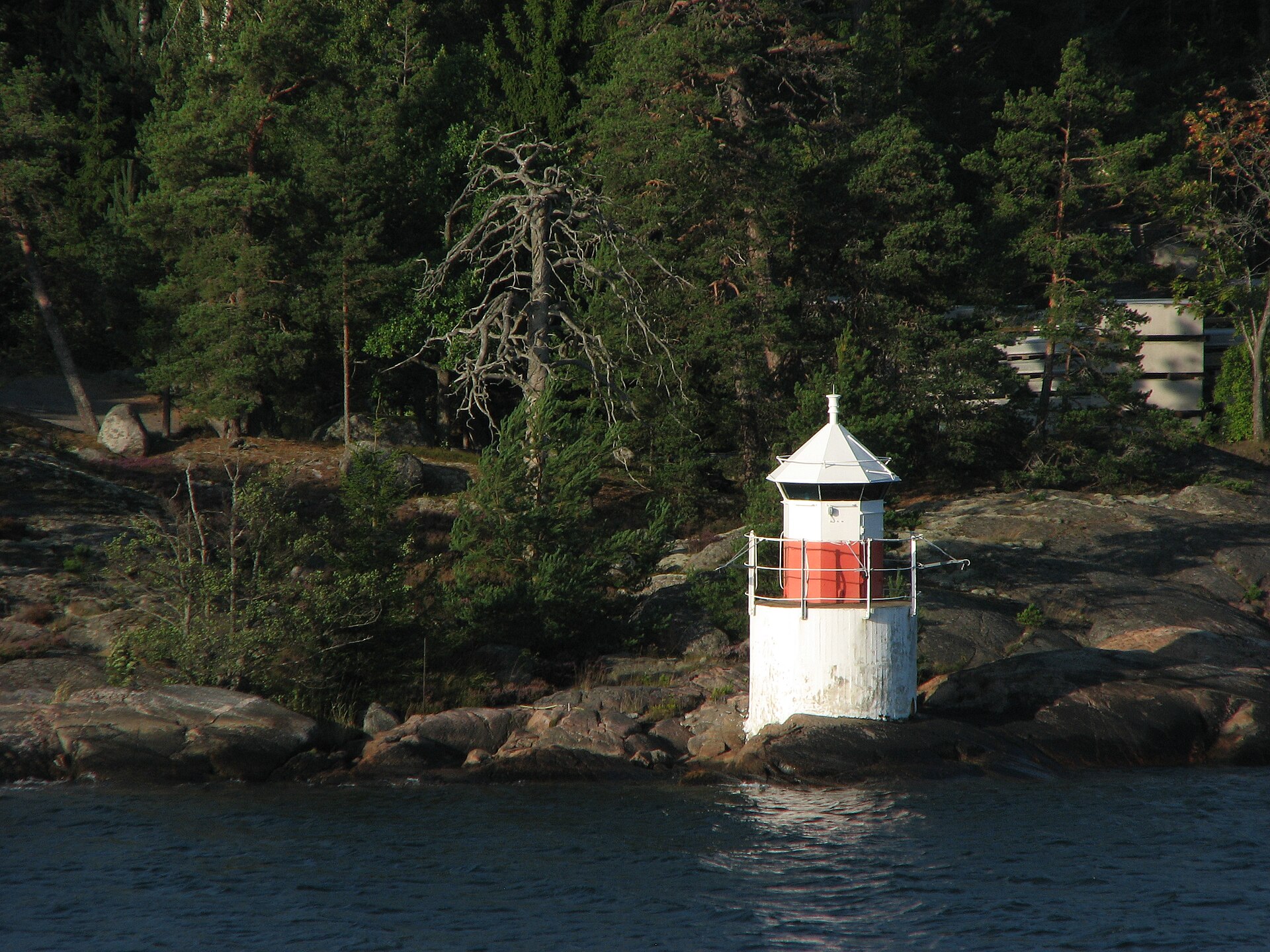
The further out the boat goes, the fewer trees, the lower the land, and the more the granite itself becomes the landscape rather than a backdrop to it.
.jpg)
Is the archipelago administratively part of Stockholm?
Only partly, and mostly not. The archipelago spans several municipalities within Stockholm County (Stockholms län), including Stockholm municipality itself for the innermost islands, but stretching into Norrtälje, Värmdö, Haninge and Nynäshamn municipalities further out. It is a single geographic and cultural region without being a single administrative one — which is one reason ferry services, rather than any city boundary, are what actually define how the area is used and understood.
How is it different from the islands the city itself is built on?
Central Stockholm is also built on islands — Gamla Stan, Södermalm, Kungsholmen and others — but these are connected by bridges, run on city transit, and function as ordinary urban districts. The archipelago proper begins where that infrastructure stops: where reaching an island means a boat, not a bridge or a metro line. Readers curious about the city’s own island geography, as distinct from the outer archipelago, can find that covered separately in the guide’s piece on which islands Stockholm itself is built on.
How do people actually get out there?
The main year-round operator is Waxholmsbolaget, the regional public ferry company, which runs scheduled services from central Stockholm out to islands across all three zones; timetables thin out considerably outside summer, so anyone planning a trip should confirm current departures on the operator’s own site. Private operators run seasonal routes to specific islands, particularly in summer. The mechanics of this — which piers serve which islands, how ticketing works, and what changes between June and January — are set out in the guide’s dedicated piece on how the archipelago boats work by season.
For a first attempt at working the archipelago into a trip that also includes the city itself, the practical logistics are addressed in how to fit the archipelago into a short trip, and in a day in Stockholm on the water, which looks at how boat-based days in and around the city actually fit together.
Can you walk or camp freely once you’re out there?
Much of the archipelago’s uninhabited land is covered by allemansrätten, Sweden’s right of public access, which allows walking, swimming and short-term camping on most land not directly attached to a private garden, regardless of who owns it. It comes with real limits — on distance from houses, on fires, on protected nature reserves — rather than being an unrestricted right to go anywhere. The rule itself, and where it stops applying, is explained fully in what allemansrätten actually covers.
Does anyone actually live out there year-round?
Yes, on the larger middle-archipelago islands especially. Places like Vaxholm and Utö have permanent populations, schools, shops and year-round ferry links, distinct from the seasonal population that arrives for the warmer months on smaller, summer-house islands further out. This split between a small permanent archipelago population and a much larger seasonal one shapes everything from ferry frequency to which shops stay open past August — a pattern more visible to residents planning a visit outside peak summer than to a first-time visitor.
Why does the size of the archipelago matter for planning a visit?
Because “the archipelago” is not one trip. An inner-archipelago island near Fjäderholmarna is a half-day outing; an outer island like Sandhamn is close to a full day once ferry time is counted both ways, and weather and season change what is even running. Treating the number of islands and the distance involved as background, rather than the whole answer, is what prevents a visit built around a single ferry timetable from collapsing when it turns out the last boat back leaves earlier than expected.
For a broader sense of how a trip to the water fits against everything else Stockholm offers in a limited number of days, the guide’s planning hub at Stockholm practical information sets out the wider context, and the Parks & Archipelago and Day Trips archives cover specific islands and routes in more depth. Anyone weighing the archipelago against life in the city more generally may also find Living in Stockholm useful, since the pattern of who goes where, and when, is as much a resident’s habit as a visitor’s itinerary.
Access Stockholm is an independent guide written from published, checkable sources. We have not visited the places described here and we do not publish personal recommendations or invented ‘local favourites’ — where something is singled out as notable, we say who says so. Opening times, fares, closures and prices change at short notice, so treat everything here as a starting point and confirm with the museum, operator or venue directly before building a day around it. We give no advice on visas, insurance, health or safety; use your own government’s official guidance for those.
Featured image: Photo by Егор Журавлёв from Smarde, Latvia, source, CC BY-SA 2.0
.jpg)